BY: Faith Ueckermann, IVM & GIS Specialist, Grow With Trees
Why Accuracy Matters
Accurate and consistent data collection is essential to a successful vegetation monitoring program. Small inconsistencies in the field can create significant challenges when data is reviewed and analyzed later. When information is collected consistently, less time is needed for data cleaning and quality control, and there is greater confidence that the results accurately represent conditions on the ground.
Plot Location and Photo Collection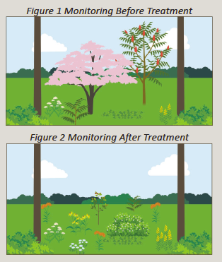
Accurate plot locations are especially important when monitoring the same plots over multiple years. Returning to the same location allows changes in vegetation to be tracked over time and helps demonstrate the impacts of vegetation management treatments. However, leaving permanent stakes or other physical markers is not always practical. Delineating plot boundaries within GIS provides an alternative, giving future collectors a consistent spatial reference to help them return to the same location year after year.
Photos provide additional context that may not be captured through survey fields alone. For permanent plots, photos taken from the same location and direction can provide a clear before and after record of vegetation conditions. Establishing guidelines for the number, location, direction, and subject of photos makes these comparisons more meaningful. Paired with accurate plot locations and monitoring data, repeat photography can document how a site is evolving and visually communicate treatment results.
Avoiding Data Entry Errors
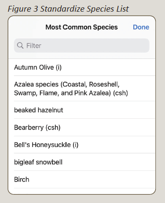
A well-designed survey should make it as easy as possible for users to enter information correctly. One of the simplest ways to improve consistency is to use dropdown menus rather than standard text entry. For example, species names entered manually may include spelling errors, abbreviations, or different versions of common names. A standardized species dropdown ensures that the same species is recorded consistently by every user.
Standardized data lists (See Figure 3 to the left) can also be used to reinforce key vegetation management messages with field collectors. Compatible species that the utility wants to conserve can be marked with a designation such as “csh” within the species list. This helps collectors recognize desirable species and reinforces the importance of avoiding unnecessary treatment when those species are encountered elsewhere in the field. Similarly, regulated or priority invasive species can be identified with an “i” in the species list. Increasing the visibility of these species helps collectors recognize plants that may require special attention, particularly when working within protected areas or when the utility is implementing an invasive species management plan.
Surveys should also only request information when it is relevant. When using apps like Field Maps or Survey123, conditional visibility can be used to display questions based on previous responses. Species entry only appears when a percentage greater than zero is entered for the vegetation category (ex. compatible forbs)(see highlighted area in Figure 4 below). This prevents collectors from scrolling through unnecessary fields or accidentally entering data in the wrong spot. Different species lists can also be displayed for different vegetation categories (see highlighted area in Figure 5 below), reducing the likelihood of species being entered in the wrong category.
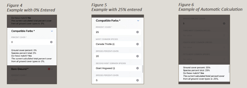
When collecting percent cover, an automatic calculation can also display the total percentage entered (see highlighted area in Figure 6 above). This gives collectors an opportunity to identify potential errors while they are still at the plot rather than during data review at the end of the field season.
These features do more than improve data quality. They make surveys faster and easier to use, allowing collectors to focus on observing vegetation rather than navigating unnecessary questions.
Turning Accurate Data into Improvements
The ultimate purpose of collecting monitoring data is not simply to create a dataset, it is to improve the vegetation management program. Consistent, accurate data makes it possible to identify patterns across the system and determine where management practices are working well and where additional attention may be needed.
Monitoring results can highlight areas with lots of incompatible vegetation, invasive species, or other conditions that may require changes in treatment timing or methods. At the same time, successful areas can provide valuable lessons. Comparing sites with desirable vegetation conditions to sites that are struggling can help identify management practices that could be applied elsewhere.
Accurate monitoring data can also demonstrate program success. Results showing improvements in compatible vegetation, habitat conditions, treatment effectiveness, or other program objectives provide measurable evidence of the benefits of vegetation management practices. These results can be shared with leadership, field teams, clients, regulators, and other stakeholders to communicate progress and demonstrate the value of the program.
Ultimately, better data supports better decisions. Designing field surveys with accuracy and consistency in mind ensures that the time spent collecting information in the field translates into meaningful insights and continuous improvement.
Provided By:

 Craig works for Pacific Gas and Electric as a Principal Program Manager in Land Management. His career spans 30 years in the utility industry serving numerous roles. He is an ISA Certified Arborist, Utility Specialist, and hold his TRAQ and is a TCIA Certified TreeCare Safety Professional. Craig has been engaged and involved in the UAA for many years, starting back in 2008. He then wanted more so he ran for UAA President and was elected in 2014. Today, Craig looks back over his 30-year career and wouldn’t change a thing, he’s made life-long friends and considers many as mentors. He also claims he would not be where is in his career if it weren’t for these people, and pledges to pay it forward to support others in their success.

 Sam joins the UAA crew with over a decade of non-profit experience behind her. As our Partnership Coordinator, her focused efforts on building relationships with diverse funders include crafting proposals, cultivating connections, and cohesively earning dedicated sponsors to support the sustainability of UAA substantially and empowering our programs. Well equipped with professional skills which include program development, public speaking, proposal writing, donor relations, working with diverse stakeholders, coalition building, and public-facing service. Sam’s educational background includes a BS in Animal Ecology with a minor in Animal Science, and a MA in Philanthropy and Non-profit Development.
 Jodie Braskich is an experienced professional in the utility industry with a strong background in supply chain and vegetation management. With over 18 years of industry expertise, Jodie continues to contribute her time and knowledge to the continuous improvement of the professional field of UVM. She has been a member of the UAA since 2007.
 Josh Beaver is currently senior vice president of Eocene Environmental Group, a utility vegetation management (UVM) consulting and operations firm. Josh has more than two decades of experience within the UVM industry. He is currently responsible for relationship management and oversight of long-term UVM contracts throughout the United States and Canada. He considers customer and community communication to be vital aspects of his role, and he has a proven record of success working with utilities.
 Crystal started her career in the Interior Design space but soon found herself
  Felicia brings over twenty years of leadership in management, finance, and governance, with a track record built alongside community partners, executives, and board members. The Nashville-based leader has real strengths in financial forecasting and reporting, clear communication, and the special-project work that helps executives make confident decisions. She’s a creative, collaborative problem solver who thrives in fast-paced settings where every dollar counts.
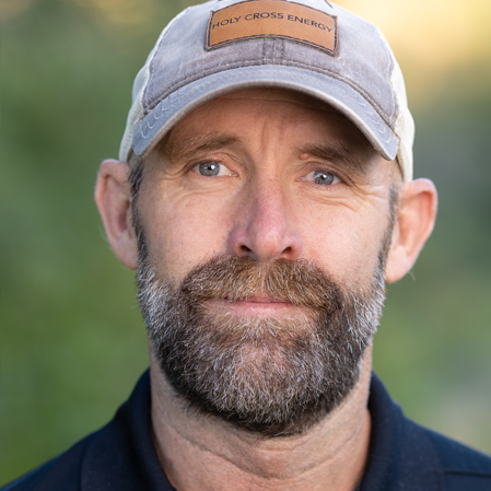 Jeff has enjoyed a 32-year career in Utility Vegetation Management. He began his career in 1993 with Holy Cross Energy as a temporary groundman. After receiving full time employment in 1994. He worked his way through the department from climber to foreman and eventually department manager in 2018. He brings a real-world approach to the industry.
 Jason is a seasoned utility vegetation management professional with almost 20 years of experience leading data-driven, field-tested programs that prioritize safety, reliability, and operational efficiency. Jason is a forward-thinking leader who integrates emerging technologies to extract insights from complex data, streamline workflows, and drive smarter decision-making across the organization.
 C. Troy Ross is the president of vegetation management at ACRT and ACRT Pacific. Shortly after graduating from Hocking College with a degree in Ranger Services and Fish and Wildlife, Ross began his career with ACRT at Southwest Tennessee Electric Membership Corporation as a contract utility forester in 1999. Since then, he has advanced through increasingly senior leadership roles, supporting vegetation management programs for a wide range of utility types and organizational structures.
 A winner of the David H Nabi Award for dedication and service, Dr. Robert Vanderhoof earned his Ph.D. from the College of Forest Resources at Mississippi State University in 1995. A veteran natural resource manager, Robert spent 15 years as Florida’s Deer Management Section Chief during which time he coordinated range management activities across Florida’s seven-million-acre wildlife management area system.
 Cindy is the Senior Director, Vegetation Management Services and she manages departments responsible for maintaining vegetation in REC’s rights-of-way with the goal of reducing exposure of the electric grid to tree caused outages while encouraging habitat and species diversity. Cindy also has a consulting business, EcoAcumen, LLC that focuses on residential, commercial and government clients.
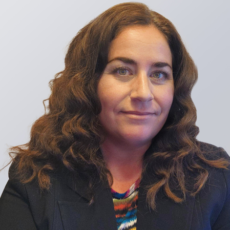 Kimberly Laing has had an exciting career in the energy industry, gaining valuable experience in various areas for almost 20 years. During her career, she has worked with numerous customers worldwide in a diverse cross-disciplined technical environment. She has extensive experience working with utilities, asset owners, equipment manufacturers, and consultants to facilitate transmission and distribution projects. Kimberly is particularly passionate about Utility Vegetation Management and its vital role in delivering safe and reliable power.
 Fallon is a Utility Arborist and Executive Director of the Utility Arborist Association. Prior to his current role he was responsible for leading vegetation management programs across several upper Midwest states on behalf of a large investor-owned utility. He’s also been an adjunct professor at the University of Wisconsin-Stevens Point, where he facilitated the
  Erin Creekmur has been in the UVM industry for over 20 years. After graduating with a Bachelors in Botany from Northern Arizona University she relocated to Northern California to start her professional career. Starting as a consulting utility pre-inspector with Western ECI she quickly moving up to the ranks to Supervisor under the tutelage of folks like Nelson Money. In 2004, Erin joined PG&E as a Quality Assurance Auditor for the VM program. Eventually becoming the Program Manager for the North Coast Division, helping stand up the beginnings of CEMA as the Emergency Drought Response Initiative Lead for the Enhanced Inspection & Mitigation Program, targeting off-cycle hazard trees across the system. In 2015, Erin moved back to her home state of Arizona and took the role of Division Supervisor with Arizona Public Service, managing both transmission and distribution UVM programs out of the Flagstaff area. As part of her role with APS Forestry Fire and Resource Management Department, Erin had responsibility for creating a Hazard Tree Mitigation program. maintaining APS’s ROW Stewardship Accreditation, FERC reporting, and the Transmission Lidar program. In 2021, Erin took a shift in her career and is now Supervising the Customer Construction and Design team for APS, expanding her overall understanding of the Utility industry. Erin continues to maintain her ISA Utility Specialist Certification and TRAQ. She has also completed certifications in both Six Sigma and Lean Sigma Green Belt through accredited universities. In addition to her current service on the UAA Board of Directors, Erin spent the last 6 years as an officer with the Arboretum at Flagstaff Board of Directors. In her free time, you can find Erin in the woods taking pictures of native plants and beautiful western landscapes.
 Christopher King serves as Director of Operations at ArborMetrics Solutions (AMS), based in North Carolina. In this capacity, he is responsible for overseeing operational activities across multiple accounts throughout the Eastern United States. With more than a decade of experience in the utility vegetation management (UVM) industry, Mr. King has held a diverse range of roles, including Groundperson, Foreperson, Contract Forester, Vegetation Management Program Manager, Business Development Manager, and Director of Operations Support.
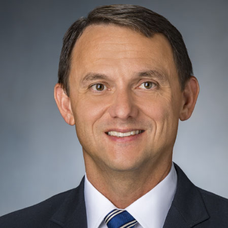 Matt Goff is a Transmission Vegetation Manager at Georgia Power Company. He lives in Brookhaven, GA with his wife, two daughters, and the family’s two dogs Sam, and Payton. For leisure, he enjoys sports with his family, bird hunting, and salt-water fishing.Matt holds a BSFR from the University of Georgia in Forest Resource Management and he graduated in 1997. He has worked in the vegetation management industry for 26 years. His work experience includes six years as a procurement forester for a forest products manufacturer, and 20 years in the utility vegetation management industry with Georgia Power.
 Cody is the Membership Office Coordinator for the Utility Arborist Association, where she supports membership operations with a focus on organization and engagement. She blends her experience in organizing systems, interpreting data, and working closely with people to support both the day-to-day and big-picture needs of the UAA.